- Home
Edition
Africa Australia Brasil Canada Canada (français) España Europe France Global Indonesia New Zealand United Kingdom United States- Africa
- Australia
- Brasil
- Canada
- Canada (français)
- España
- Europe
- France
- Indonesia
- New Zealand
- United Kingdom
- United States
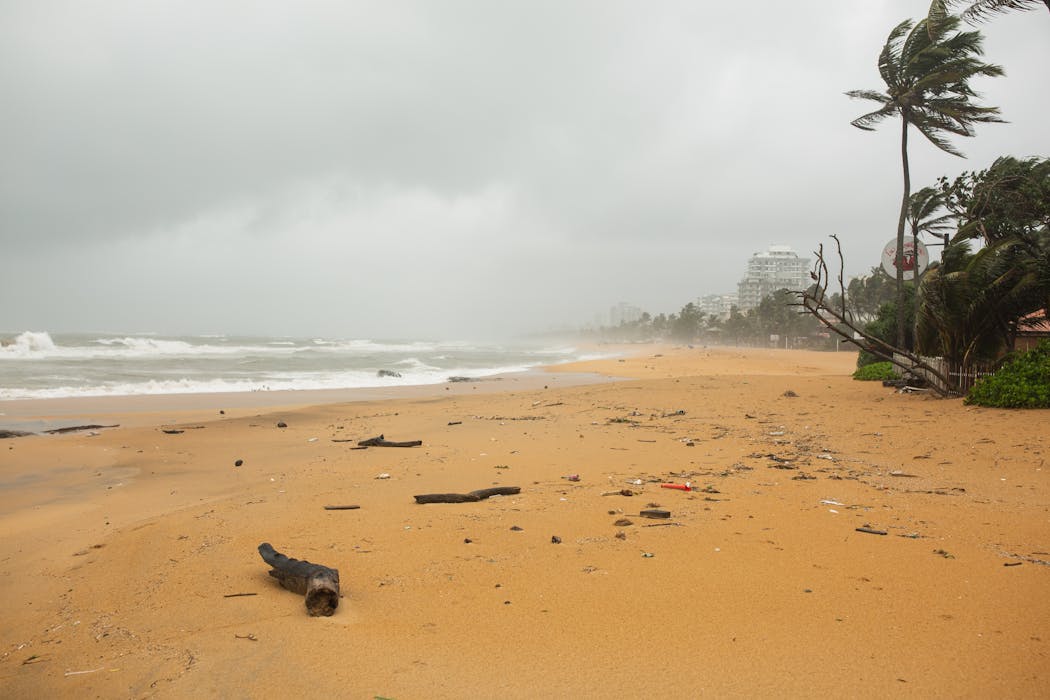
 Cyclone Ditwah hit Sri Lanka on November 28 2025.
Alina Polat/Shutterstock
Sri Lanka’s latest climate-driven floods expose flaws in disaster preparations – here’s what needs to change
Published: December 3, 2025 5.45pm GMT
Ravindra Jayaratne, University of East London
Cyclone Ditwah hit Sri Lanka on November 28 2025.
Alina Polat/Shutterstock
Sri Lanka’s latest climate-driven floods expose flaws in disaster preparations – here’s what needs to change
Published: December 3, 2025 5.45pm GMT
Ravindra Jayaratne, University of East London
Author
-
 Ravindra Jayaratne
Reader in Coastal Engineering, University of East London
Disclosure statement
Ravindra Jayaratne receives funding from the Natural Environment Research Council (NERC), UK.
Partners

University of East London provides funding as a member of The Conversation UK.
View all partners
DOI
https://doi.org/10.64628/AB.nuyyc3n9j
https://theconversation.com/sri-lankas-latest-climate-driven-floods-expose-flaws-in-disaster-preparations-heres-what-needs-to-change-271181 https://theconversation.com/sri-lankas-latest-climate-driven-floods-expose-flaws-in-disaster-preparations-heres-what-needs-to-change-271181 Link copied Share articleShare article
Copy link Email Bluesky Facebook WhatsApp Messenger LinkedIn X (Twitter)Print article
When Cyclone Ditwah made landfall on November 28 2025, Sri Lanka experienced one of its deadliest environmental disasters in modern history.
President Anura Kumara Dissanayake declared it the “largest and most challenging natural disaster in our history”. Torrential rains triggered widespread floods and landslides, leading to more than 350 confirmed deaths, hundreds missing and over 1.4 million people affected nationwide.
Major road and rail systems were cut off, hydropower stations and water treatment plants failed, and thousands of families were forced into emergency shelters. Reservoirs overflowed, riverbanks collapsed and communities near the Mahaweli, Kelani, Malwathu Oya and Mundeni Aru river basins were inundated within hours.
These were not random failures. They were systemic. Many of the regions that flooded were vulnerable areas adjacent to coastal lagoons and low-lying river plains. Cyclone Ditwah was not an anomaly. It exposed the underlying fragilities of Sri Lanka’s existing flood-management and drainage infrastructure.
This follows on from the devastating tropical cyclone in 1978 and the Boxing Day 2004 tsunami disaster. Fifty years ago, flood infrastructure was not in a good state. Significant improvements haven’t been made since then, mainly due to poor urban planning.
Between 2018 and 2022, I worked with a global team of coastal engineers, social scientists and policy makers from academia and government organisations in the UK, Australia and Sri Lanka. Our research project focused on producing a new generation of compound flood hazard maps, based on computer modelling that considers all the storm surge components (surge, tide and sea level rise) and the rainfall effect.
I led the hydrological modelling efforts for Sri Lanka – focusing on how tropical-cyclone rainfall and storm surge combine to generate destructive flooding patterns for three vulnerable cities: Batticaloa, Mullaitivu and Mannar. The team worked with Sri Lanka’s Coast Conservation and Coastal Resource Management Department (CCD) to address a critical question: How do storm surges from tropical cyclones interact with rainfall to produce extreme inland and coastal floods?
Through analysis of historic cyclone tracks, we showed that Sri Lanka lies at the convergence of multiple storm pathways in the Bay of Bengal. This is why the country repeatedly suffers not only from rainfall-driven inundation but also from saltwater intrusion driven deep inland through lagoons and estuaries.
My team and I developed the hydrologic model for Batticaloa, using the Mundeni Aru river basin as a pilot case. We combined rainfall data, digital terrain maps (that indicate trees, buildings, roads and bare land) and river-flow simulations to identify the most vulnerable communities depending on the topography. Low-lying settlements adjacent to the Batticaloa and Valachchenai lagoons were particularly vulnerable to tropical cyclone-induced flooding.
 Streets flooded as Ditwah Cyclone hit Sri Lanka (November 30 2025).
Thamara Perera/Shutterstock
Streets flooded as Ditwah Cyclone hit Sri Lanka (November 30 2025).
Thamara Perera/Shutterstock
Similar modelling work was proposed for Mullaitivu and Mannar, both historic cyclone-landfall regions. However, COVID disrupted much of the planned in-country engagement, in-depth modelling and translation of findings into policy tools, creating a serious lag between scientific insights and what planning authorities are currently referencing.
Ditwah’s aftermath – breached embankments, power failures, displaced families, submerged neighbourhoods – corresponds almost exactly to the worst-case compound-flood scenarios shown by our data. These are not purely meteorological phenomena. They depend on the flow of water and land-based infrastructure.
Drainage networks still rely on outdated historical rainfall records. Coastal defences are built for storm surges of previous decades. Urban development continues to occupy natural flood buffers such as wetlands and lagoon edges. Vulnerability has become physically engineered into the landscape.
Proactive planning
Working with government agencies including the CCD, the Met Office and the Disaster Management Centre, Sri Lanka can proactively integrate compound-flood science into planning and disaster risk-reduction strategies.
This includes producing updated flood maps that capture rainfall, river flow, storm surge and sea-level-rise dynamics. Hydrological models can be translated into operational tools for national and municipal planning authorities.
Drainage and river-management systems (such as seasonal removal of sand and debris) can be redesigned with the future (not historical) rainfall intensities in mind. Improving early-warning systems involves incorporating multiple hazards and long-range scenario modelling can be embedded into disaster-preparedness and land-use planning.
Read more: Boxing Day tsunami: here's what we have learned in the 20 years since the deadliest natural disaster in modern history
These measures enable policymakers, engineers and local administrations to make evidence-based decisions that reflect accelerating climate-driven risks rather than obsolete assumptions.
Cyclone Ditwah should mark a turning point. With the right integration of science, planning and governance, disasters of this magnitude need not become inevitable hallmarks of Sri Lanka’s future. And by aligning infrastructure and policy with the real hydrological dynamics of our changing climate, governments can better protect people, environment and economy from the storms yet to come.

Don’t have time to read about climate change as much as you’d like? Get a weekly roundup in your inbox instead. Every Wednesday, The Conversation’s environment editor writes Imagine, a short email that goes a little deeper into just one climate issue. Join the 47,000+ readers who’ve subscribed so far.
- Floods
- Sri Lanka
- Cyclones
- Extreme weather
- Disaster preparedness
- Keep me on trend
Events
Jobs
-
 Respect and Safety Project Manager
-
Associate Dean, School of Information Technology and Creative Computing | SAE University College
-
Senior Lecturer, Clinical Psychology
-
University Lecturer in Early Childhood Education
-
Case Specialist, Student Information and Regulatory Reporting
- Editorial Policies
- Community standards
- Republishing guidelines
- Analytics
- Our feeds
- Get newsletter
- Who we are
- Our charter
- Our team
- Partners and funders
- Resource for media
- Contact us
-
-
-
-
Copyright © 2010–2025, The Conversation